Continuing on from my previous two posts about camping in the furthest reaches of New South Wales. See here for my sketches and here for photos from the first half of the journey. The details of where we went are in the post with the sketches, so please go to that one to get a full overview.
I left the last post in Dunlop Station, which once was an enormous sheep property on the Darling River. Now there is not a lot of land, but a grand old house, a shearing shed which was once the biggest and most modern in NSW, a building which once was a shop for local people containing stores of all kinds of equipment and now is a treasure house of historical equipment. It is all being steadily restored by the owners who also welcome campers.
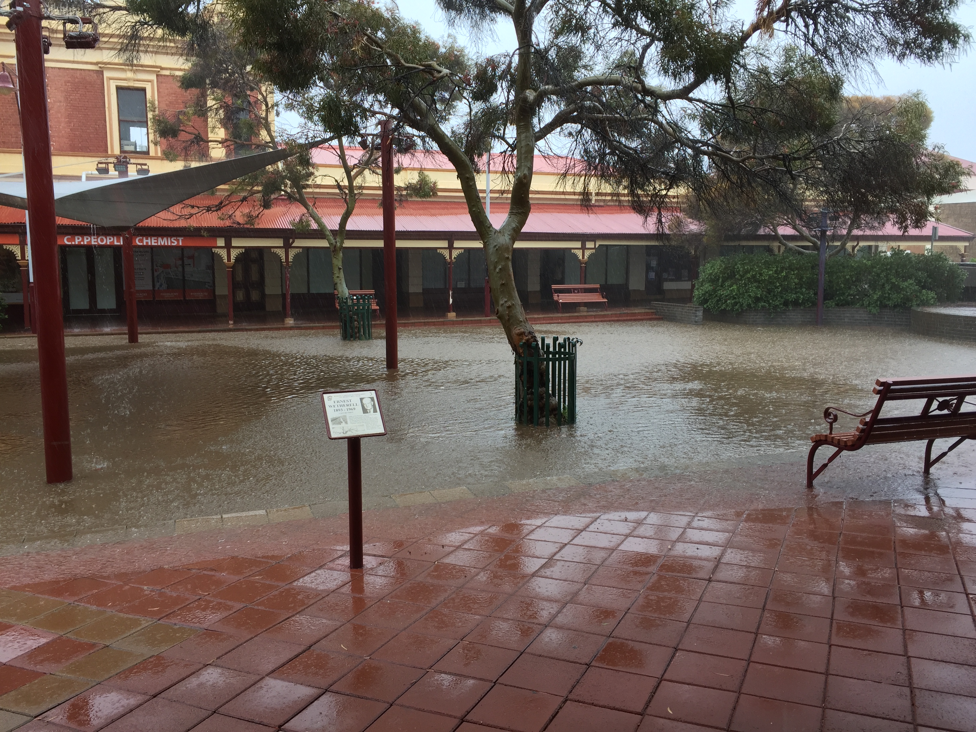
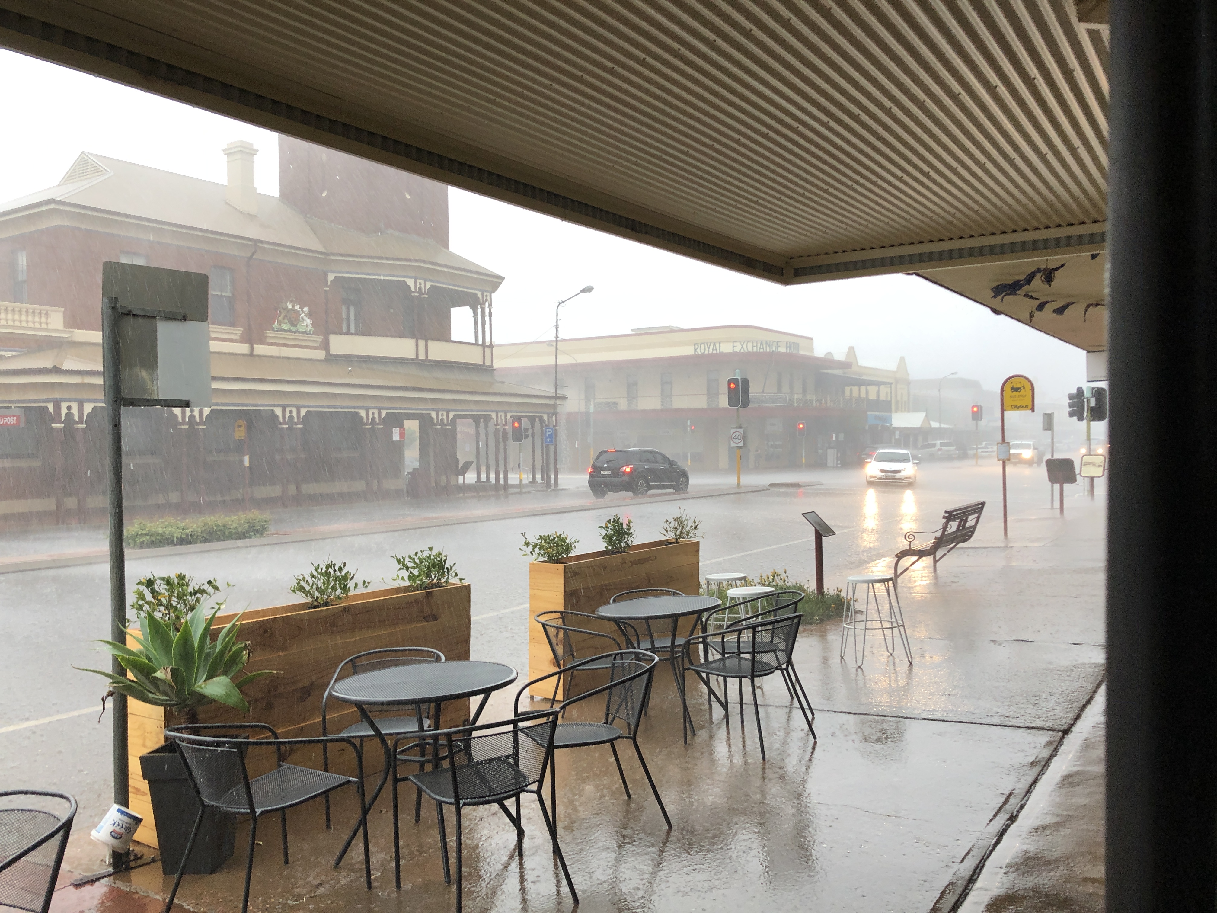
From there we made our way to Broken Hill, a vibrant silver mining town on the border with South Australia, where we stayed for five days as an extreme storm cell made its way across the country. There was flash flooding in the city and most of the roads out were closed for several days, since they are dirt and the flood waters had caused washaways and damage to many of them, and vehicles destroy the roads driving on them while they are wet, even if they don’t become bogged.
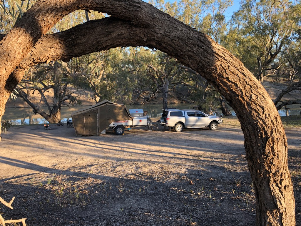
Set up on the Darling river at Dunlop Station 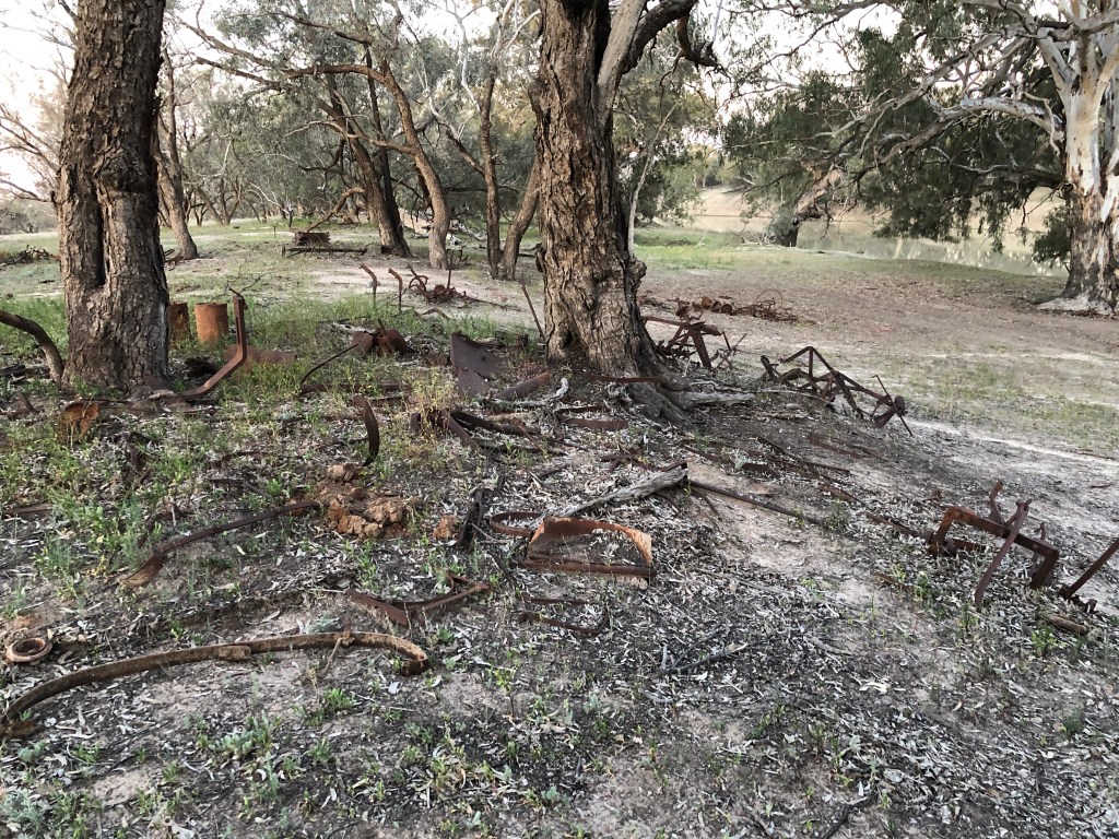
The view behind us – the campsite was called ‘The Graveyard’ because it was full of the remains of old farm machinery
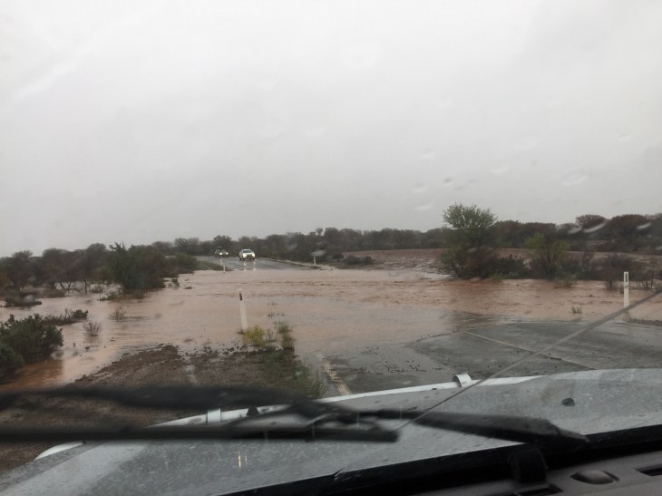
The road from Broken Hill to Silverton after the storm 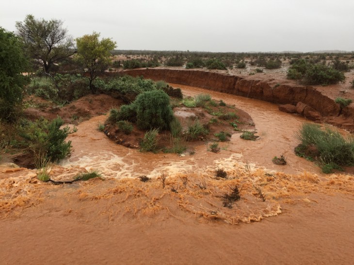
The day before, this was dry dirt – it became a torrent in minutes 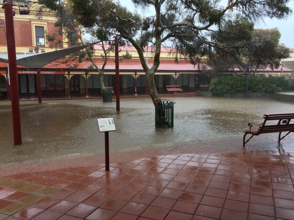
The water filled a grass area to a depth of about 60 cm 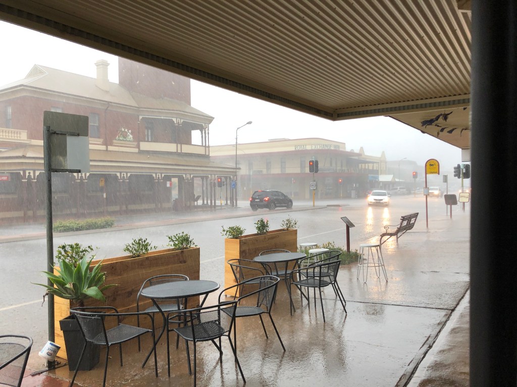
The rain beginning in Broken Hill

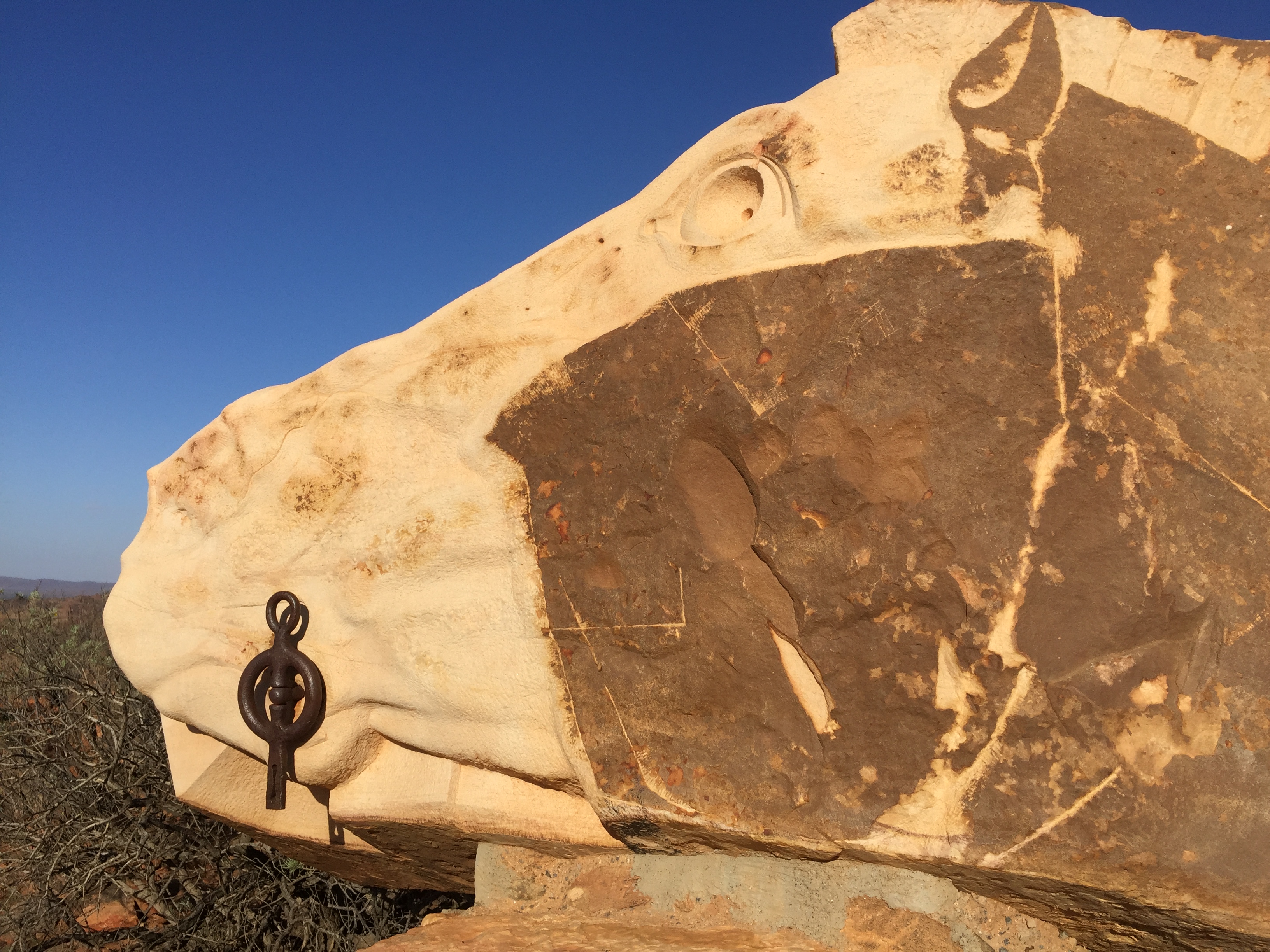
The Living Desert cultural area outside Broken Hill 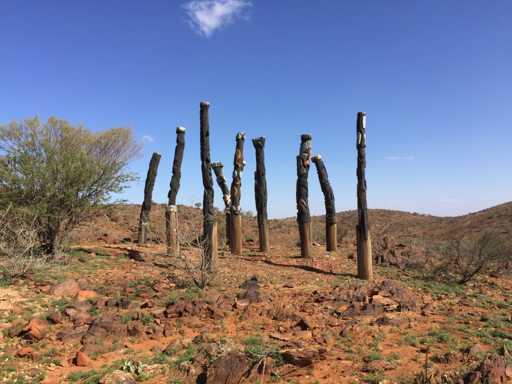
Sculptures made by school students on the top of a hill in the Living Desert 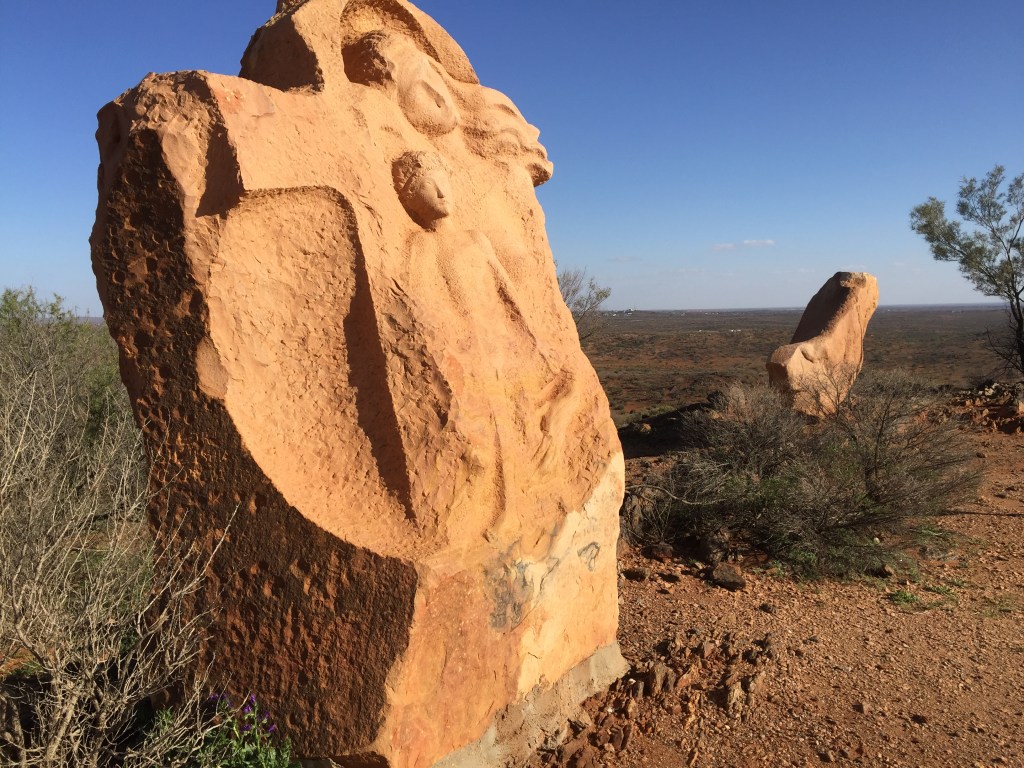
Living Desert sculptures – massive sandstone blocks were carved in situ by 8 local and international sculptors in 6 weeks in 1991. 
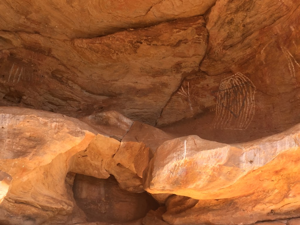
Aboriginal rock art 
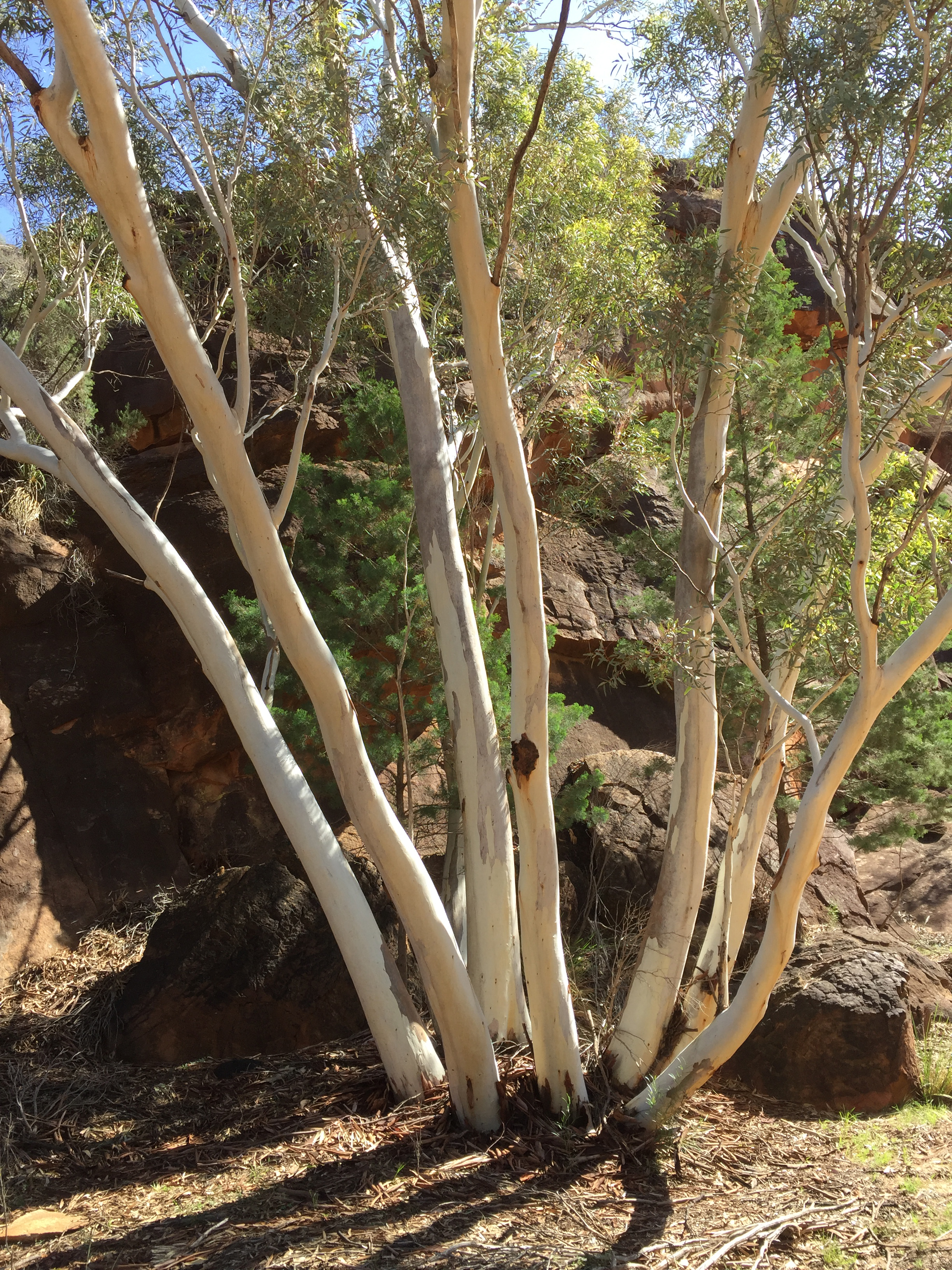
Homestead Gorge 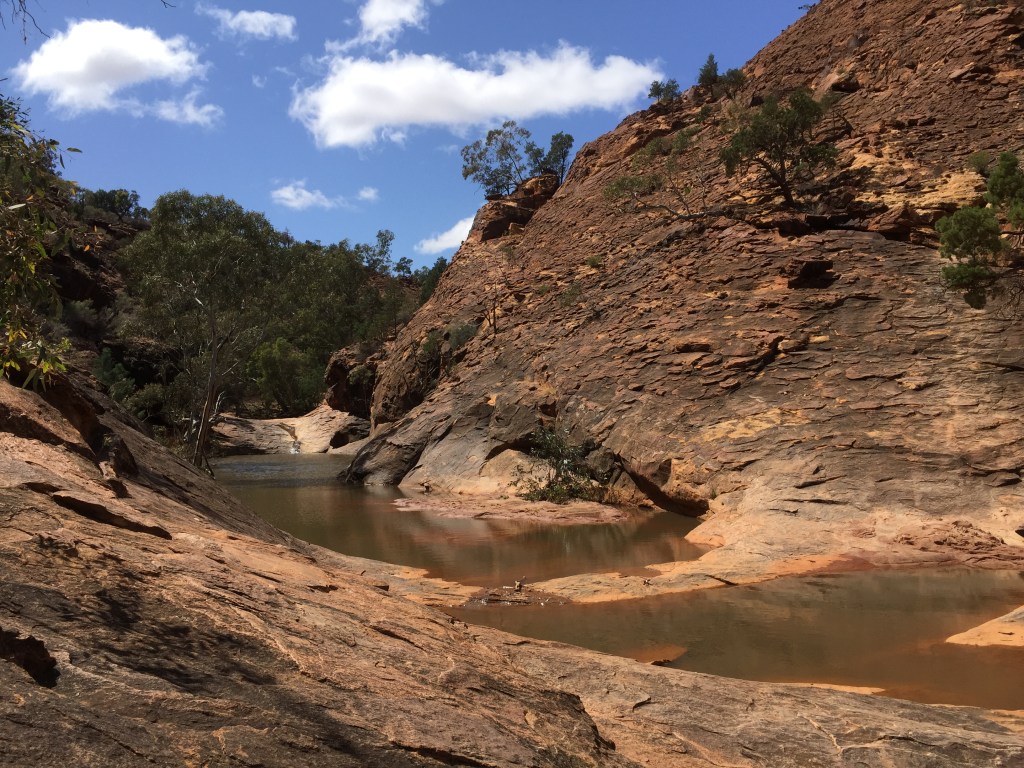
Pools on the top of Homestead Gorge 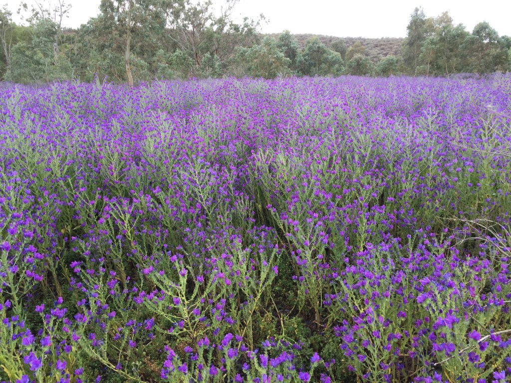
Masses of Patterson’s Curse – a weed but so beautiful 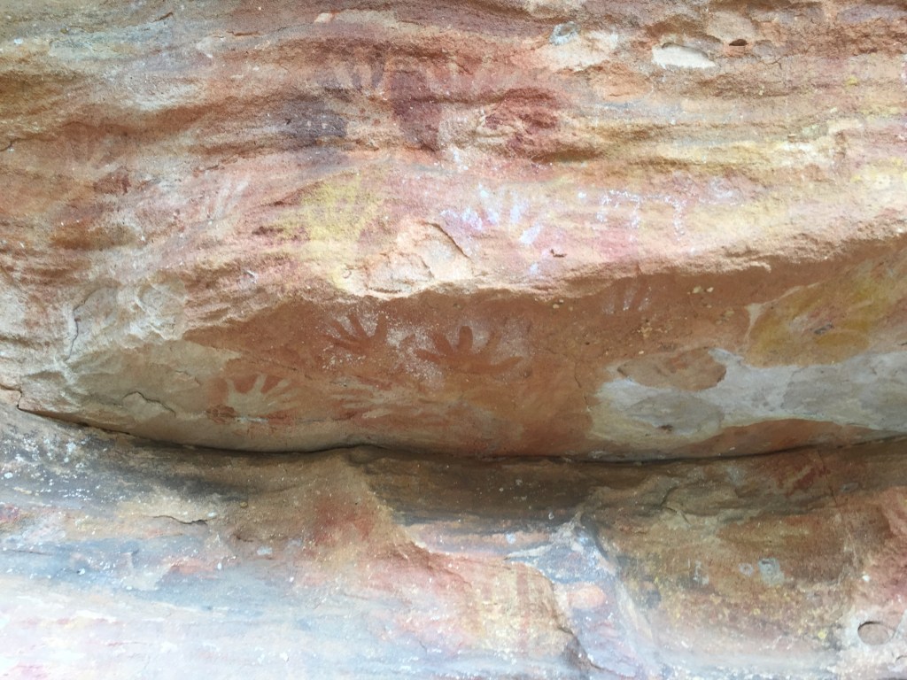
Aboriginal hand prints 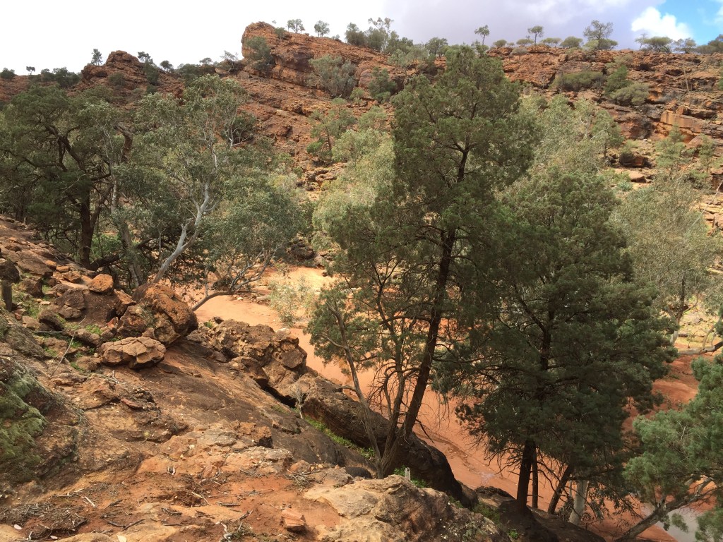
Looking down into Mutawintjie Gorge 
Almost at the end of Mutawintjie Gorge 


Great job, Anna! Thank you!
LikeLiked by 1 person
Delighted you enjoyed the photos Fabio – thank you!
LikeLiked by 1 person
You have covered many miles for those photos! Thanks so much! Best wishes! 🙂
LikeLiked by 1 person
Yes, it was quite a long way. Best wishes to you too!
LikeLike
❤
LikeLike
Thank you!
LikeLiked by 1 person
Welcome!
LikeLiked by 1 person
Looking at the photos of Broken Hill I could swear I’d been there but I haven’t. It looks so much like Kalgoorlie. It must have been quite an adventure to have the heavens open unexpectedly. I remember when it poured in Kalgoorlie the roads became awash immediately because there weren’t any gutters or drains. Not that it did anything for cleaning one’s vehicle as the water was always brown.
All the areas you’ve photographed have their charm. It must have been an inspirational trip. The Peery Lake skies are beautiful. As are those inland sculptures. We should be annoyed at the Pattersons Curse but it is so pretty, like the lupins in the South Island of NZ which are also considered weeds but are heavenly!
LikeLike
You’re right, Broken Hill is very like Kalgoorlie, I imagine they were probably settled around the same time. I love the frontier-ness of those towns, although I think Kalgoorlie is wilder. I felt a little guilty enjoying the Patterson’s Curse so much, but it was spectacular! Those skies to me are really emblematic of the outback, small tight puffs. Peery Lake was initially a disappointment as we had been told there were 50,000 birds there – we counted 6! Not thousands … once we got over that, we enjoyed it for the landscape and the small dry but beautiful flowers.
LikeLike
More wonderful views from your camera Anna! Your landscape is so different than here. Some looks a bit like our south west. I loved the sculptures both sandstone and totem poles, so interesting and unexpected. The Aboriginal rock art and hand prints are simply amazing. I love seeing your beautiful skies, so blue. I agree the Patterson’s Curse is really a treat. Okay I must confess, I love all the names of these places, animals and plants. Thank you again for sharing all of this wonderment!
LikeLike
I enjoy the names too Cathe – and you know Patterson’s Curse is known as Salvation Jane in some parts of Australia! This is because it flourishes when nothing else will, so becomes useful cattle feed in desperation, but I think it has substances in it that mean long term use does cause internal problems for animals. I do like the idea of the two very contrasting names. There are some parts of outback Australia that I think look like places such as Arizona, judging from photos, but there is also much that is unique. The skies are wonderful, and the cloud formations often ones you don’t see elsewhere. Some of the rock art we came upon by chance, it is always a delight to see, the sense of a people living there, often in very harsh conditions for many thousands of years.
LikeLike
Another exciting camping adventure Anna ! Such contrasts in all respects you show us with those photos .
You’ll never run short of ideas or inspiration for your art work I’m sure 😉
And … as another contrast …
*Merry Christmas* to you and yours xx
LikeLike
Thank you Poppy, and I hope it has been a lovely Christmas for you too. We are very lucky here to have the virus under control (pretty much!) but it is a constant worry about our friends and family in the UK, so I do hope you are staying well. These trips we have just had have been wonderful, it felt great to be out and about again, it puts the world’s problems into perspective! Do stay well- let’s hope 2021 is better all round!
LikeLike
Good to hear Anna . Thankfully we are keeping well and adapting to lockdowns and tiers … also taking extra care as we are the support ‘bubble’ for a friend .
I’m all for a 2021 turnaround with the positive advances in the vaccine roll out 🙂
LikeLiked by 1 person